Useful Links
Climbing and Hiking

- http://www.ashikaparsad.com/trip-planning-links/: A cornucopia of trip-planning links, including weather reports, webcams, trail conditions, etc. compiled by Ashika Parsad and Ryan Morasiewicz
- bivouac.com: Robin Tivy’s masterful and definitive international encyclopedia of peaks, with a comprehensive focus on southwestern British Columbia. Comprehensive peak statistics as well as photographs, trip reports, photographs, and maps.
- clubtread.com: The best discussion forum for hiking in southwestern British Columbia, with coverage of adventures all around the world. Extensive discussion of peak routes, conditions, and secrets.
- facebook.com/groups/baggerchallenge/: Facebook page for the Bagger Challenge (closed group; invitation required)
- peakery.com: An useful and fun means of recording peak-bags around the world. Plots your conquests on an international map. Extensive collection of photographs, with growing collection of trip reports and routes.
- peakfinder.org: Plug in a peak name or longitude/latitude and this amazing site and app will generate a rotating 360° view of the visible peaks, with names.
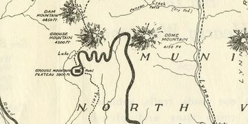
Maps
- District of North Vancouver Geoweb: The District of North Vancouver geoweb website has two detailed topographic maps with trails and roads for front-row peaks. The website is a treasure trove of thematic maps and mapping resources, including a cycling map with routes, a hydrology map with stream and lakes, and an interactive map with historic events in the District. Prepare to spend an afternoon browsing.
- District of West Vancouver Map: More interactive but a little slow and clunky, it features skins of creek names and topography: westmap2.westvancouver.ca/westmap2015/map.htm.
- GoogleMaps: Everyone knows and loves this amazing resource. Peak enthusiasts can re-activate the enormously useful terrain feature, with contour lines, slope shadowing, and more names of topographical features by clicking on the lined menu button in the top left of the map, and choosing the “terrain” view. Invaluable for route-planning: google.ca/maps.
- Google Earth: Also invaluable for route-planning as well as projecting GPS data to display your routes: google.com/earth/.
- OpenStreetMap: An open-source street and trail map, with a great selection of established and obscure North Shore trails and peaks: openstreetmap.org/#map=15/49.5285/-122.8975.
Mountain History and Culture


